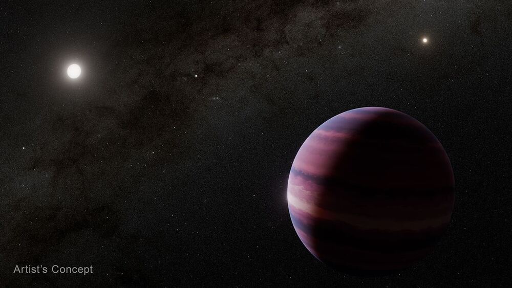
Geologist Tim Little measuring curved scratches on the Alpine Fault. (Nic Barth/UCR)

UC Riverside explores earthquake forecasting techniques

To improve earthquake forecasting and gain insights into potential seismic activities, scientists have introduced a groundbreaking method that analyzes fault dynamics and enhances the accuracy of earthquake predictions. This innovative technique, detailed in a paper published in the journal Geology, explores the intricate details of past earthquake events, providing valuable information about the origins of quakes, their propagation patterns, and the geographical areas likely to experience significant seismic impacts.

At the core of this approach are advanced supercomputer modeling techniques that allow for a thorough analysis of fault activities, which ultimately helps in creating more precise earthquake scenarios for significant fault lines. By closely examining the subtle curved scratches left on fault surfaces after an earthquake—similar to the markings on a drag race track—researchers can determine the direction in which the earthquakes originated and how they moved toward specific locations.

The lead author of this groundbreaking study, UC Riverside geologist Nic Barth, explains the importance of these previously unnoticed curved scratch marks. Supercomputer modeling identified the shape of these curves relative to the earthquake's direction; the research establishes a solid foundation for determining the locations of prehistoric earthquakes. This understanding provides a pathway for forecasting future seismic events and improving hazard assessment strategies globally.

One of this study's key findings is its ability to reveal critical information about the origins and trajectories of earthquakes. This knowledge is vital for predicting potential initiation points of future seismic events and understanding their likely paths. Such insights are significant for earthquake-prone areas like California, where accurate forecasts can significantly reduce the impact of earthquakes.

The study also highlights the need to understand earthquake propagation and its implications. For example, researchers examine a large earthquake that starts near the Salton Sea on the San Andreas fault and propagates northward toward Los Angeles, demonstrating how different earthquake origins and directions can affect energy dispersion and impact intensity.

Furthermore, this research extends its focus to international fault lines, notably New Zealand's Alpine Fault, known for its seismic activities. By analyzing historical earthquake patterns and modeling potential scenarios, the study showcases the predictive power of this new technique in forecasting seismic behavior and informing preparedness measures in earthquake-prone regions worldwide.

In a time characterized by increased seismic risks and an emphasis on disaster readiness, employing advanced supercomputer modeling techniques to analyze earthquake dynamics offers a promising path forward in earthquake science. As researchers globally adopt this innovative approach to uncover the complex history of faults and refine seismic predictions, the potential to enhance earthquake preparedness and response mechanisms grows, providing hope for communities at risk from seismic events.

Overall, this new horizon of knowledge promises to transform our understanding of earthquake science, offering a powerful tool to improve our comprehension of seismic behavior and strengthen global resilience against the unpredictable forces of nature.

These maps illustrates significant changes in 6,167 reaches of the largest rivers on earth—44.2% saw decreases in streamflow and 11.9% saw increases over 35 years. Of nearly 1.5 million of the smallest, upstream rivers on earth, 17% of rivers saw a 1-5% increase in streamflow (blue) while 9.9% saw a decrease (red) over 35 years.

Supercomputer modeling revolutionizes understanding of global river changes

A groundbreaking study published in Science by researchers from the University of Massachusetts Amherst and the University of Cincinnati has unveiled a new era in river monitoring. This research marks a significant advancement in our understanding of river ecosystems by mapping 35 years of river changes on a global scale for the first time. The collaboration among hydrologists has revealed a concerning shift in river flow patterns: downstream rivers are experiencing a decline in water flow, while smaller upstream rivers have seen an increase.

The core of this transformative research lies in the innovative use of supercomputer modeling and satellite data to assess river flow rates across 3 million stream reaches worldwide. This advanced approach enables researchers to monitor every river, every day, everywhere, over the span of 35 years, providing a comprehensive and real-time insight into the evolution of our rivers.

Lead author Dongmei Feng, an assistant professor at the University of Cincinnati, and co-author Colin Gleason, the Armstrong Professional Development Professor of civil and environmental engineering at UMass Amherst, have paved the way for a deeper understanding of how rivers respond to various factors, including climate change and human intervention. By utilizing the power of supercomputers, they have accessed a wealth of previously unavailable data, shedding light on the complex dynamics of river systems.

This study's optimistic tone lies in its significant potential for informed decision-making and sustainable resource management. By identifying specific changes in river flow rates, communities worldwide can better prepare for disruptions in water supply, mitigate the impact of floods, and plan for future hydropower development. The data generated from this supercomputer modeling highlights the challenges we face and provides practical insights into how we can adapt and thrive in a changing environment.

Furthermore, this research highlights the critical role that advanced technology plays in addressing complex environmental issues. Integrating large-scale computation, modeling, data assimilation, remote sensing, and innovative geomorphic theory has allowed researchers to present a comprehensive view of global river landscapes. This optimistic outlook marks a new chapter in hydrological research, where supercomputers serve as powerful tools for transformation and progress.

As we embark on this journey of discovery and innovation, the hopeful spirit of this study fuels our collective efforts to safeguard our rivers, protect our ecosystems, and build a more sustainable future for generations to come. With supercomputer modeling leading the way, the possibilities are endless, and the potential for positive change is within reach.

The NASA Terrestrial Hydrology, Early Career Investigator, and Surface Water and Ocean Topography Programs supported this research.

Empowering resilience: The role of Woolpert in utilizing big data for flood inundation modeling

In a significant advancement for navigation safety and flood modeling, Woolpert has been chosen by the National Oceanic and Atmospheric Administration (NOAA) for an Indefinite Delivery, Indefinite Quantity (IDIQ) contract to conduct hydrographic surveys. This five-year collaboration promises to leverage cutting-edge technology and big data to enhance our preparedness for environmental challenges.

The core of this partnership involves Woolpert providing the Office of Coast Survey (OCS) with vital bathymetric data collected through vessel-based hydrographic survey services. These data will be gathered and processed using state-of-the-art multibeam and side-scan sonar technologies. They will support the creation and maintenance of accurate nautical charts and play a crucial role in developing flood inundation modeling strategies. This data will aid in the smooth flow of maritime activities and habitat mapping initiatives, laying the groundwork for improved navigation safety and environmental resilience.

Woolpert's collaboration with NOAA reflects a shared commitment to using big data to tackle critical issues related to flood risks and maritime navigation. By utilizing advanced survey methods and data analytics, they establish a strong foundation for creating comprehensive flood inundation models that enhance our understanding of potential risks and inform proactive mitigation strategies.

Woolpert's involvement in this hydrographic survey IDIQ contract extends beyond technological innovation. By helping to create accurate nautical charts and supporting flood inundation modeling, the company aligns with broader goals of promoting sustainable development, protecting coastal communities, and encouraging environmental stewardship. Their use of advanced geospatial technology and engineering expertise exemplifies a unified vision for a more resilient and adaptable future.

Woolpert's commitment to fostering a culture of growth, diversity, and inclusion emphasizes their dedication to holistic progress. By nurturing an environment that values innovation, collaboration, and continuous learning, Woolpert sets an example of industry leadership that goes beyond technical excellence to embrace the ideals of equity and sustainability.

As Woolpert embarks on this transformative journey with NOAA, the potential to use big data to enhance flood modeling and navigation safety inspires optimism. Through a blend of technological capability, scientific rigor, and collaborative spirit, Woolpert's initiatives demonstrate the transformative power of innovation in building a more resilient and secure future for coastal communities and maritime activities.

In summary, Woolpert's selection by NOAA marks the beginning of a new era of technological innovation and collaboration to improve navigation safety, strengthen flood inundation modeling efforts, and promote environmental sustainability. This partnership embodies a vision of resilience, empowerment, and progress, promising a brighter future for coastal regions and beyond.

The bottom shows the light curve of the gamma-ray flare, while the top displays quas-simulated images of the M87 jet taken during the 2018 campaign in radio and X-ray at various scales. The instrument, observation wavelength, and scale are noted at the top left of each image.

M87's powerful gamma-ray outburst: Supercomputer simulation unveils the mysteries of the Universe

In a significant advancement in understanding celestial phenomena, the recent discovery of a rare gamma-ray outburst from the supermassive black hole M87 has generated excitement and opened new avenues for astrophysical research. This cosmic event has been thoroughly examined through cutting-edge supercomputer simulations, a historic achievement facilitated by the National Astronomical Observatory of Japan. This scientific endeavor illuminates the mysterious processes at the center of M87 and highlights the collaborative spirit that transcends geographical boundaries.

The gamma-ray outburst observed during the 2018 Event Horizon Telescope (EHT) campaign has ignited renewed interest in understanding the complex mechanisms governing the phenomena around M87. A notable aspect of this discovery is the high-energy gamma-ray flare, which unlocks valuable insights into the dynamics of particle acceleration, event horizons, and emissions that challenge conventional understanding.

The integration of advanced observational techniques, theoretical models, and state-of-the-art technology is at the forefront of this achievement. The supercomputer at the National Astronomical Observatory of Japan has been crucial in simulating and analyzing the movement of ultra-high-energy particles within M87's jet. This work raises fundamental questions that have intrigued scientists and enthusiasts for decades. The synergy between observational data, theoretical predictions, and supercomputer simulations highlights the interplay between technological advances and scientific inquiry, paving the way for remarkable discoveries in our understanding of the Universe.

Integrating observational data from the EHT and multiple wavelength campaigns conducted with over two dozen global facilities has created an exceptional data archive. This dataset provides a comprehensive view of the high-energy emissions from M87. By merging data from ground-based and space telescopes—including NASA's Fermi-LAT, HST, NuSTAR, Chandra, and Swift telescopes—and advanced Imaging Atmospheric Cherenkov Telescope arrays like HESS, MAGIC, and VERITAS—researchers can examine the gamma-ray outburst with unprecedented accuracy.

From a scientific perspective, this revelation is set to usher in a new era of understanding the Universe. It empowers researchers to investigate the workings of supermassive black holes, the nature of particle acceleration, and the fundamental physics behind celestial phenomena with renewed passion and optimism. The meticulous supercomputer simulation conducted by the National Astronomical Observatory of Japan offers crucial insights into the Universe's inner workings, likely inspiring numerous theoretical predictions and empirical studies that push the boundaries of current knowledge.

Additionally, this collaborative effort exemplifies the essence of scientific exploration, transcending national borders to foster a global community of collaboration and innovation. The combination of diverse perspectives, theoretical frameworks, and technological advancements creates a harmonious synergy that embodies the transformative potential of scientific inquiry, fostering an optimistic outlook for future research and collaboration.

In summary, the discovery of M87's rare gamma-ray outburst, enhanced by sophisticated supercomputer simulations, marks a pivotal milestone in astrophysical research. This development heralds a new era of scientific optimism and collective effort, inspiring future generations of researchers, scholars, and enthusiasts to gaze at the cosmos with endless fascination and determination, ready to uncover the Universe's mysteries one simulation at a time.

Concerns about the NASA, DOD study on coastal groundwater saltwater mixing

A recent study conducted by researchers at NASA’s Jet Propulsion Laboratory, in collaboration with the U.S. Department of Defense (DoD), has made bold claims about the potential widespread contamination of coastal groundwater by saltwater by the year 2100. The study suggests that factors such as sea level rise and slower groundwater recharge due to climate change will play crucial roles in driving saltwater intrusion into coastal aquifers around the world. However, can we truly accept these predictions at face value?

Published in Geophysical Research Letters, the study evaluates over 60,000 coastal watersheds globally, considering the effects of rising sea levels and decreasing groundwater recharge on saltwater intrusion. The researchers employed a model that accounted for various factors, including groundwater recharge rates, water table elevation, fresh and saltwater densities, and patterns of coastal migration.

While the methodology in this study appears comprehensive, it still warrants critical examination. The projection that saltwater will invade approximately 77% of the assessed coastal watersheds by the end of this century raises questions about the accuracy of such estimates. The complex interactions among climate change factors and hydrological dynamics make it notoriously difficult to forecast the precise extent of saltwater intrusion over the next 80 years.

Moreover, the suggestion that officials in affected regions can mitigate saltwater intrusion by protecting groundwater resources or diverting groundwater presents practical challenges. Implementing such strategies globally may face logistical and financial obstacles that could undermine their efficacy.

Skeptics may argue that relying on models and simulations, despite their sophistication, introduces an element of subjectivity and potential biases that could influence the results. Additionally, the co-funding of the research by NASA and DoD raises concerns about possible conflicts of interest or agendas that might affect the study's direction and reporting.

The involved researchers, including lead author Kyra Adams and coauthor Ben Hamlington, emphasize the importance of their findings for shaping future groundwater management policies. Nonetheless, it is essential to approach these claims with healthy skepticism, considering the myriad factors at play and the uncertainties inherent in long-term climate predictions.

In conclusion, while the NASA-DoD study on saltwater intrusion in coastal groundwater by 2100 offers valuable insights into the potential impacts of climate change on global water resources, a discerning approach is necessary. The complexities of hydrological systems and the dynamic nature of environmental processes require a nuanced evaluation of such forecasts to ensure sound decision-making and effective adaptation strategies in an uncertain future.