ACADEMIA
NRL Monterey Develops More Accurate Tropical Cyclone Prediction Model
While the predictions of the paths or tracks of hurricanes, more generally referred to as tropical cyclones (TC), have steadily improved over the last few decades, improvements in the predictions of storm intensity have proven much more difficult.
“Over the past two years, the COAMPS-TC model has shown to be the most accurate emerging research model for predicting tropical cyclone intensity,” said Dr. Jim Doyle, research meteorologist, NRL Monterey. “There is no better example of these difficult challenges than the intensity predictions for Hurricane Irene this past August.”
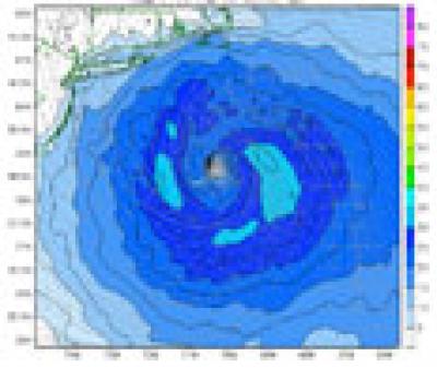
Producing very accurate intensity predictions during a real-time experimental demonstration of Hurricane Irene, COAMPS-TC intensity errors were six knots on average for a series of three-day forecasts, a clear improvement over the official National Hurricane Center (NHC) forecast and other operational models that ranged from 20-30 knots.
The successful predictions have demonstrated that Numerical Weather Prediction (NWP) models can outperform operational statistical-dynamic models that are based on climatology and previous behavior. It is further believed that NWP models, which explicitly predict the location, dynamics and intensity of a storm, will eventually provide the most promising approach to achieve accurate TC intensity and structure prediction.
Advancing further methodologies used for vortex initialization, data assimilation and representation of physical processes, COAMPS-TC is expected to become fully-operational in 2013 at the Navy’s Fleet Numerical Meteorology and Oceanography Center (FNMOC) in Monterey. Considerable advancements have been made to several components of the modeling system including the data assimilation of conventional and special TC synthetic observations, vortex initialization, and representation of key TC physical processes such as air-sea fluxes, clouds and convection.
The COAMPS-TC project will potentially signal a paradigm shift in TC forecasting and is already making a strong impression on the forecasting community. Focusing on the development and transition of a fully coupled air-ocean-wave prediction system, the COAMPS-TC model includes nonhydrostatic atmospheric dynamics, multiple nested moving grids that follow the center of the storm and improved boundary layer and cloud physical parameterizations.
COAMPS-TC was first tested in real-time in support of two field campaigns sponsored by the Office of Naval Research (ONR). The Tropical Cyclone Structure-08 (TCS-08) conducted as part of The Observing System Research and Predictability Experiment (THORPEX) Pacific Asian Regional Campaign (T-PARC) in 2008 and the Impact of Typhoons on the Ocean in the Pacific (ITOP) in 2010, both of which took place in the Western Pacific. Additionally, COAMPS-TC advancements and real-time demonstrations in the Eastern Pacific and Western Atlantic have taken place through collaboration with the National Oceanic and Atmospheric Administration (NOAA) as part of the Hurricane Forecast Improvement Project (HFIP) —a community-wide effort focused on improving operational hurricane prediction.
In June 2011, COAMPS-TC was one of nine worldwide winners of the inaugural High Performance Computing (HPC) Excellence Award presented at the ISC-11 International Supercomputing Conference in Hamburg, Germany — an award presented annually to recognize noteworthy achievements by users of HPC technologies. As a result, COAMPS-TC was recognized for achieving ‘a significantly improved model for tropical cyclone forecasting.’ COAMPS-TC development benefited significantly from the Department of Defense HPC Modernization Program Office (HPCMO) computational assets at the Navy Defense Supercomputing Resource Center (DSRC) at Mississippi’s Stennis Space Center.
Increasingly-sophisticated developmental versions of COAMPS-TC will continue to be demonstrated in real-time and in support of the Joint Typhoon Warning Center and the National Hurricane Center. A key additional enhancement will be a fully coupled ocean-atmosphere version in which the NRL Costal Ocean Model (NCOM) and the Wave Watch III (WWIII) will provide the ocean circulation and wave components, respectively.
The advancement in TC intensity forecasts with COAMPS-TC are based on the long-term S&T investment in mesoscale processes and model development from the NRL base program and the ONR Marine Meteorology Program. The understanding of tropical cyclone dynamics has been accelerated in recent years through several ONR-supported field observation campaigns that include Coupled Boundary Layers Air-Sea Transfer (CBLAST), TCS-08 and ITOP-10. The final technical push of COAMPS-TC model development came from a Rapid Transition Program project jointly supported by ONR and the Oceanographer of the Navy through PEO C4I&Space PMW-120. Advancements of COAMPS-TC and real-time demonstrations have also been supported by NOAA’s Hurricane Forecast Improvement Project (HFIP).


